A Common Operating Picture

Emergency response software

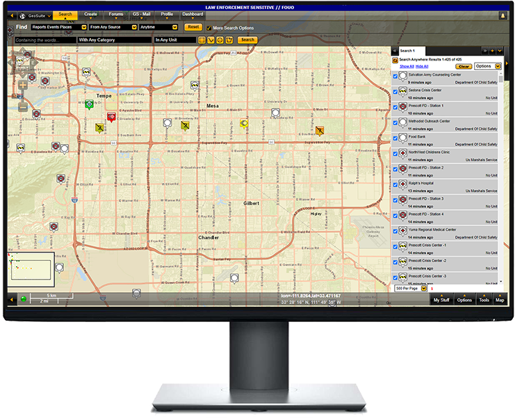
GeoSuite™ is a web-based emergency response software that provides advanced situational awareness and information sharing for first responders. The tool enables first responders to collect, report, and share real-time information for enhanced decision-making and effective response during emergencies, public events, or Operations Center management.

Features

  • Advanced displays feature color-coding and priority levels.
  • On the scene views using live sensor feeds.
  • Immediate first-responder location updates.
  • Built to be used anytime and anywhere.
  • Record and maintain data for after-action reporting, training, and mission refinement.
  • Hosted on a web-based server, using rugged field servers when communication is down.

Benefits

  • Collaborate using a common operating picture
  • One system is used across multiple sources.
  • Applicable in a fusion center, operations center, or mobile.
  • Quickly identify first-responder locations.
  • Receive live event updates.
  • Regardless of the terrain or region, the technology is adaptable.
  • A mobile app allows for immediate reporting.

Featured Video

Texas Task Force 1 used Geosuite’s emergency response software to track disaster operations in real-time, improve efficiency, and save lives.