Among the first to arrive on the scene of an emergency, first responders need robust and accurate data that is readily available to save lives. GeoSuite™ answers that need, providing real-time data used in fast-paced environments to disseminate information quickly and efficiently.
The web-based emergency response software was developed for field use and allows users to be in constant communication while responding to emergencies. This critical functionality saves time, resources, and lives. Learn more about how GeoSuite™ can provide your organization with emergency response incident information, and make your operations more effective.
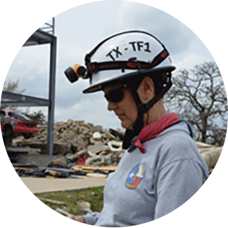
To create a common operating picture and execute a seamless, real-time command structure across multiple agencies, TX-TF1 deployed GeoSuite™ – a web-based, advanced situational awareness and information-sharing solution from nFocus Solutions™ that was critical to the organization’s Hurricane Harvey rescue mission. TX-TF1 has been using GeoSuite™ since 2013 to collect, report, and share real-time information for enhanced decision-making and effective response during emergencies.
With GeoSuite’s emergency response software in hand, mission-critical data becomes instantly available across multiple sources during dynamic emergency situations, enabling easy collaboration between teams and agencies. The organization noted three primary benefits to TX-TF1 of using GeoSuite™ over other GIS tools to support search and rescue efforts. First, GeoSuite™ enables two-way communication between field personnel and the operations dispatchers. Second, GeoSuite™ provides field access to historical GIS data, allowing search and rescue personnel to leverage prior knowledge of local assets and risks. Finally, GeoSuite™ has been specifically augmented with features that support search and rescue data needs across not just dispatch and monitoring, but also stakeholder communication and reporting functions.
Client
Texas A&M Task Force 1 (TX-TF1)
Challenge
In August of 2017, Hurricane Harvey swept through Southeast Texas. In response to the overwhelming destruction; local, state, and federal organizations deployed more than 20,000 rescue workers who needed a common operating picture to successfully complete its mission.
Using Geosuite to coordinate its emergency response to Hurricane Harvey, TX-TF1 was able to create a common operating picture and execute a seamless, real-time command structure across multiple agencies, and more than 2,500 rescue workers.
Executive Summary
To create a common operating picture and execute a seamless, real-time command structure across multiple agencies, TX-TF1 deployed GeoSuite™ – a web-based, advanced situational awareness and information-sharing solution from nFocus Solutions. TX-TF1 has been using GeoSuite™ since 2013 to collect, report, and share real-time information for enhanced decision-making and effective response during emergencies.
With GeoSuite™ in hand, mission-critical data becomes instantly available across multiple sources during dynamic emergency situations, enabling easy collaboration between teams and agencies. The organization noted three primary benefits to TX-TF1 of using GeoSuite™ over other GIS tools to support search and rescue efforts.
First, GeoSuite™ enables two-way communication between field personnel and the operations dispatchers. Typical GPS-based communications are only “push” solutions, allowing dispatchers to send coordinates to the field. With GeoSuite™, however, field responders can also send data on their location and field conditions back to dispatchers and operations centers. Breland notes that this feature was particularly helpful in dealing with 911 and 211 call information during Hurricane Harvey. For example, in Fort Bend County, the sheer number of emergency calls overwhelmed local authorities, with roughly 1,500 calls going unaddressed. To improve response time, TX-TF1 established a call center, determined the level of need for each call, and entered each call location into GeoSuite™ along with situational information (e.g., number of affected residents and severity of need). Responders in the field received call data on their phones and used GeoSuite™ to make immediate, targeted checks on residents requesting assistance. Once the responders assessed each call situation, they were able to report status changes and any requests for additional assistance back to the call center through GeoSuite™. Consequently, emergency responders were able to attend to every single call in only 36 hours.
Second, GeoSuite™ provides field access to historical GIS data, allowing search and rescue personnel to leverage prior knowledge of local assets and risks. By simply dialing back to a map layer containing data from a previous disaster (e.g., a flood) in the same area, responders who may have never been to a particular site can use GeoSuite™ to immediately learn the lay of the land. This knowledge helped TX-TF1 responders make tactical decisions like planning rescue routes that avoided areas prone to flash flooding in the past.
Finally, GeoSuite™ has been specifically augmented with features that support search and rescue data needs across not just dispatch and monitoring, but also stakeholder communication and reporting functions.
Client
Texas A&M Task Force 1 (TX-TF1)
Challenge
In August of 2017, Hurricane Harvey swept through Southeast Texas. In response to the overwhelming destruction; local, state, and federal organizations deployed more than 20,000 rescue workers. Texas Task Force 1 (TX-TF1), one of 28 federal teams within the FEMA Urban Search and Rescue Response System, was responsible for overseeing the efforts of nearly 25% of these rescue workers.
Solution Used
To create a common operating picture and execute a seamless, real-time command structure across multiple agencies, TX-TF1 deployed GeoSuite™ – a web-based, advanced situational awareness and information-sharing solution from nFocus Solutions.
Outcome
The unwavering manner in which TX-TF1 and partners executed their deployment during the Harvey disaster is in keeping with the TX-TF1 mission of doing the most good for the most people in the least amount of time. In the end, TX-TF1 and collaborating agencies mobilized for 16 days in rescue mode, performing 12,982 rescues, 35,046 evacuations, 4,335 welfare checks, and over 2,000 pet and other animal rescues.
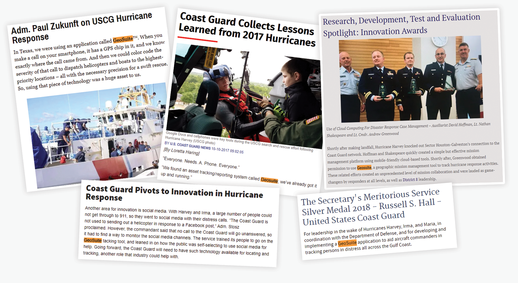
nFocus Solutions™ donates use of GeoSuite™ for U.S. Coast Guard Hurricane Response and Rescue
Incident Overview
Aggregated field and other relevant data can be viewed in GeoSuite™, providing a unique overview of incidents that give managers the information they need to make well-informed decisions.
Effective Operations
Record every detail of incident responses with GeoSuite™ across multiple agencies, so departmental information can be centrally accessed and managed.
Emergency Preparedness
Give first responders the data they need to save lives with GeoSuite™. Ensure support is available and nearby when needed, using aggregated field related data.